
Adventurers worldwide have long known of the iconic Appalachian Trail that spans America’s east coast, but it wasn’t until a 2014 Hollywood movie titled Wild, based on a thru-hiking memoir, that the Pacific Crest Trail was catapulted to the forefront of public imagination. So what is the Pacific Crest Trail?
Long and more treacherous than its east coast counterpart, the Pacific Crest Trail, or PCT, took many more years to complete and gain notoriety, but today it sees roughly the same number of thru-hikers as the Appalachian Trail. We take a look at the history and unique topography of the PCT to understand why a growing number of people are fleeing office blocks and cities to set their hiking boots on this epic mountain path.
What is the Pacific Crest Trail?
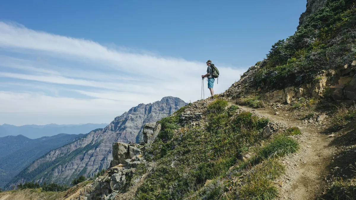
The PCT is a 2,650 mile long hiking and equestrian trail that roughly follows the Cascade and Sierra Nevada mountains near the west coast of the U.S. Travelling north, the trail spans the entire length of the U.S. from Mexico to Canada and takes hikers through California, Oregon and Washington.
The official start of the PCT is a California border town called Campo and its terminus is Manning Park in British Columbia. Though the PCT is near sea level in parts, much of it is at high altitude with its highest point being Forester Pass near Mount Whitney at 13,180ft.
Together with the Appalachian Trail on the east coast and the Continental Divide Trail in the Rockies, the PCT forms part of the Triple Crown of Hiking.
The Pacific Crest Trail: from Mexico to Canada
Why was the Pacific Crest Trail created?

The idea for the PCT is generally attributed to Clinton Churchill Clarke, who proposed the idea in 1932, however Joseph Hazard, author of Pacific Crest Trails from Alaska to Cape Horn reported that Washington-based hiking enthusiast and university teacher Catherine Montgomery suggested the idea to him as early as 1926.
What is certain is that Clarke was a pioneer in grabbing publicity and planning to take the trail from vision to reality. Clarke was born in Chicago in 1873 and graduated with a master’s degree from Harvard the very same year as Appalachian Trail founder Benton MacKaye. It is not known if the two were acquainted, but certainly the post-war era was a time when many academics and outdoor enthusiasts were preoccupied with the idea of long trails and more time spent in nature.
After graduating, Clarke and his wife moved to Altadena, a southern California town that sits on the edge of Angeles National Forest just outside of LA. Here, Clarke was a founder of the Altadena Country Club and started the local boy scout movement.

In 1932, 11 years after MacKaye published his paper titled An Appalachian Trail: A Project in Regional Planning, Clarke began to circulate the idea of a trail spanning the west coast mountains from north to south. His vision was that the border-to-border trail would roughly travel along the spine of the Sierra Nevada and Cascade mountains, which lie 100 to 150 miles inland from the Pacific coast, and be mostly on Federal Lands. He forged a partnership with the U.S. Forest Service to raise awareness of the idea and enlisted the support of the YMCA, through which he met explorer Warren Lee Rogers.
Together, Clarke and Rogers organized and led the Pacific Crest Systems Conference and worked with the Forest Service and federal Civilian Conservation Corps to plan the trail.
Clarke died in 1957 and Rogers continued his tireless field work to plan the trail. The PCT was established as a permanent trail in 1968 when the National Scenic Trails Act was passed, and the route was finalized in 1972 a year before Rogers’ death, however it wasn’t completed until 1993.
How long does it take to hike the Pacific Crest Trail?

According to the Pacific Crest Trail Association, it takes the average thru-hiker about five months to complete the PCT, while some elite athletes hike it in as little as two months. Due to the high altitude of the trail, snow is a common factor and thru-hikers generally need to race against winter conditions between April and August, though southbound hikers generally can’t start until June or July.
It is not known how many people attempt the PCT each year, but the PCTA issued almost 8,000 permits in 2019, some for thru-hikers and some for section hikers. Of course, many people simply enjoy day hikes on the PCT. Between 700 and 800 people are thought to typically complete a thru-hike each year.
The first hiker to complete a thru-hike of the PCT was an 18-year-old student named Eric Ryback who did so in 1970, long before it was completed. Since then, it has been completed by hikers as young as six and in as few as 60 days and been the subject of multiple memoirs including the aforementioned Wild: Lost and Found on the Pacific Crest Trail by Cheryl Strayed.
What is so special about the Pacific Crest Trail?

Hikers on the PCT are exposed to true topographical extremes, from the rugged deserts of California to the lush fir forests of the Pacific Northwest, and from the glacial erosion that carved the Sierra Nevadas to the volcanic peaks of the Cascades.
The PCT passes through seven National Parks including Sequoia, Kings Canyon, and Yosemite. It also passes by the snow capped peaks of Mounts Whitney, Shasta, Hood and Rainier.
If you’re considering thru-hiking the PCT, read our article on how to train for thru-hiking.

