
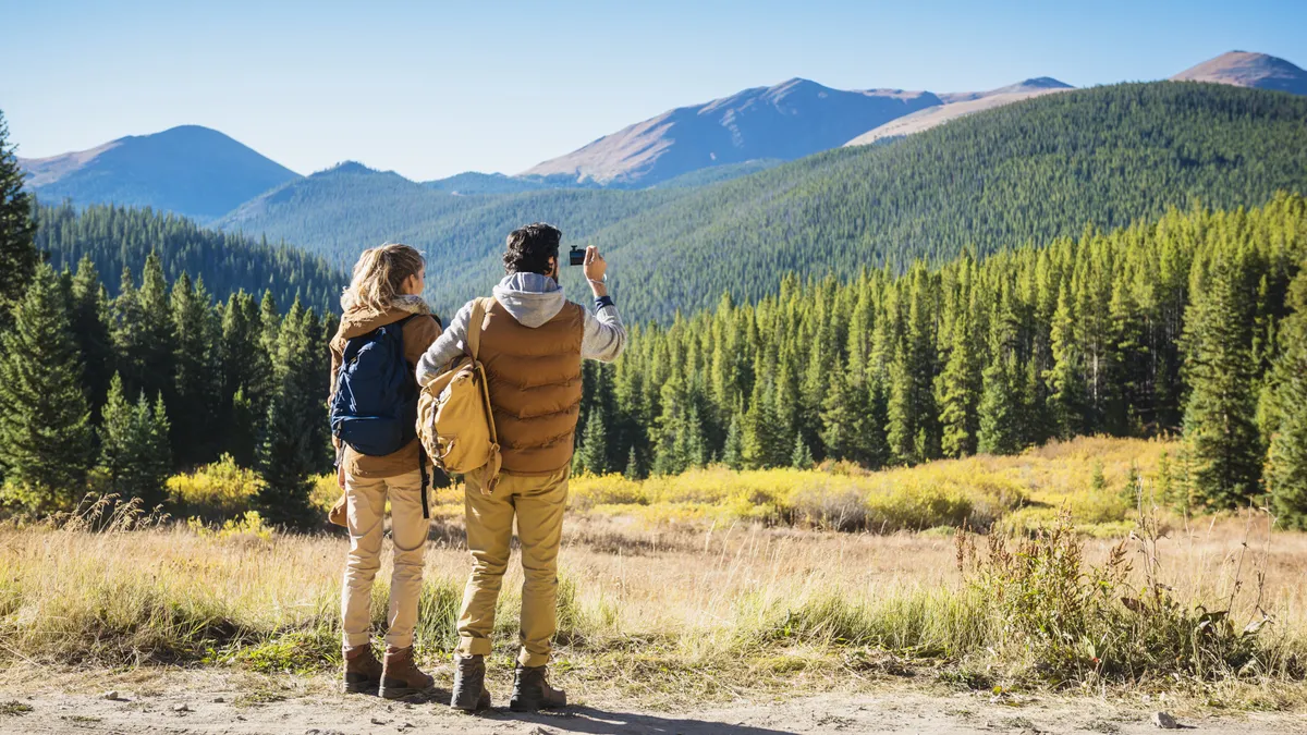
Of all of Colorado’s famous ski towns, Breckenridge may offer the most quintessential mountain getaway. Without snow or traffic, this picturesque mountain oasis is less than a two-hour drive west from Denver and at 9599ft above sea level, it will take your breath away even before you get your eyes on the spectacular surrounding Rocky Mountains. This Victorian era former mining town is nestled into the base of the Tenmile Mountain Range which lies on the northside of the Continental Divide and it’s virtually impossible not to enjoy splendid views on any of the best hikes in Breckenridge.
Once the snow melts and the resort closes, Breckenridge is transformed into a lush, green paradise for summer adventure, with high alpine hiking trails taking you across wildflower blanketed meadows to lakes and waterfalls framed by dramatic peaks, old mining ruins and up to the Continental Divide.

All trails in Breckenridge entail high altitude hiking, so if you’re arriving from sea level you’ll want to leave time to acclimate and make sure you wear good hiking boots tough enough for some rugged adventure and carry your water bottle. Summer and fall are the best seasons for hiking and mornings are the best time for summer hiking, when afternoon storms can roll in, so time your hike in order to get back to the charming downtown for lunch and a cold local brew.

If you have a car and are up for exploring other nearby areas, check out our guide to the best hikes in Vail.
Hoosier Pass Loop

Distance: 2.8 miles
Difficulty: Moderate
Looking for unbelievable views from the Continental Divide? Look no further than this relatively easy loop, which begins at the top of Hoosier Pass at 11,542ft above sea level. This high alpine loop traverses the Divide instead of being a major climb, but offers the scenery of a more arduous hike. Drive south on Highway 9 to the top of the Pass and park near the Continental Divide sign.
McCullough Gulch

Distance: 6.3 miles
Difficulty: Challenging
This splendid hike follows a mountain stream the entire way for over three miles through evergreen forests. The hike culminates in an alpine lake that is fed by gorgeous waterfalls over granite rocks and a picture perfect spot to stop for lunch. It’s a steady climb the entire way, but worth the effort. The trailhead is 2.2 miles west of Highway 9 on County Road 851 a few miles past the Quandary Peak trailhead.
Blue Lakes - Monte Cristo Gulch

Distance: 2.9 miles
Difficulty: Challenging
This hike isn’t particularly long, but it has absolutely everything you could want from a hike in Breckenridge: alpine lakes, waterfalls and old mining ruins. The hike begins at 11,748ft and stays high the entire way so the views are nothing to scoff at either. Drive 8 miles south on Highway 9. Turn right on the Blue Lakes #850 Road then turn right on the McCullough Gulch #851 Road. Drive 0.1 mile to a small parking area on the right side of the road.
Mohawk Lakes via Spruce Creek Trail

Distance: 5.2 miles
Difficulty: Challenging
If you’re up for a true alpine adventure, take the day and head up the Spruce Creek Trail to Mohawk Lakes. You’ll hike through lodgepole pine forests and alpine meadows, passing stunning Mayflower Lake and Continental Falls before arriving at the main attraction. Mohawk Lakes are pristine alpine lakes surrounded by historic mining ruins and make a perfect photo op. Head south on Highway 9 to Spruce Creek Road. The trailhead is about a mile up the road.
Crystal Lakes Trail
Distance: 8.1 miles
Difficulty: Challenging
This rugged route takes you to two beautiful alpine lakes and makes for a challenging but rewarding day. The first two miles of this trail are a road that you can drive if you have 4WD and high clearance, beginning at Lower Crystal Lake cutting your total walk time almost in half. When you get to Upper Crystal, enjoy some rest in the cabin and spectacular views of the Tenmile Mountain Range. Drive south on Highway 9 and turn right onto Spruce Creek Road. Take left turns at all the forks for approximately 1.8 miles until you arrive at the Spruce Creek Trailhead.
Quandary Peak
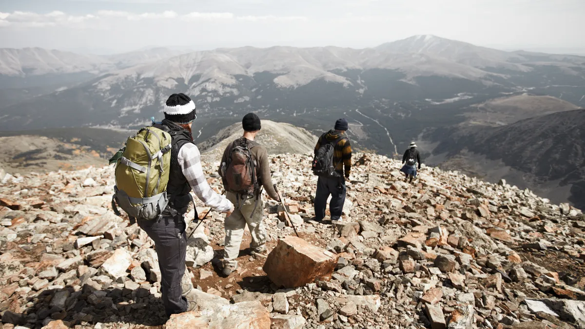
Distance: 6.1 miles
Difficulty: Challenging
Want to try hiking a 14er? Quandary is a favorite among mountain folk as one of the closer, and easier 14ers to hike. You’re certain to get up close and personal with the mountain goats that live up here (and the hoards of hikers) and enjoy the best possible views of the Tenmile Mountain Range. If you want to park at the trailhead, you will need to reserve a parking spot. To get to the trailhead, head down Blue Lakes Road from Highway 9. Turn right onto County Road 851 and the trailhead is 0.1 miles down the road. You can also use the free shuttle service from Breckenridge. The east ridge route starts almost at treeline so you will have spectacular views the entire way.
Fletcher Mountain Trail

Distance: 4.9 miles
Difficulty: Challenging
Last of all, if you really fancy the high alpine environment of a 14er but don’t want to deal with the inevitable crowds on Quandary, head to Fletcher Mountain instead. At 13,951ft tall, views from the summit are just as spectacular as any mountain ten feet higher. In fact, Fletcher is the highest “Thirteener” in the Tenmile Range. You’ll start out on an old mining road before dipping down into a valley below Quandary then beginning your climb to the summit. There are several ways to reach this trail but we recommend accessing it from the Blue Lakes trailhead. Drive 8 miles south on Highway 9. Turn right on the Blue Lakes #850 Road then turn right on the McCullough Gulch #851 Road. Drive 0.1 mile to a small parking area on the right side of the road.

