How to spot history hidden in Britain’s landscape
Every time you venture out – hiking, biking, running, camping, canoeing – clues to the past lie all around. You just need to know how to spot history hidden in the landscape

Britain is an island heaving with archaeology. It’s been continuously occupied since the end of the last Ice Age, around 12,000 years ago, and every generation has left its mark – farming, fighting, trading and building homes, roads and monuments.
From the earliest Stone Age circles, to Iron Age hillforts, to medieval woodlands still managed like they were in the time of William the Conqueror, if you know how to spot history hidden in the landscape, Britain’s history reveals itself at every turn.
- Want to explore Britain's landscape comfortably? Invest in the best hiking boots
- Get some support on your hikes with the best trekking poles
- Got everything you need for your trek? Use our hiking essentials checklist
The rules
Always keep your eyes peeled; on walks, cycling along country roads, staring out of train windows, even when you’re in the pub at the end of the day. Historical clues are all around you. So have another pint – it’s research.
Look for both natural and manmade patterns, and also note the things that break the pattern – the shape of a mound or pond, an unusual dog-legged field, or a misshapen window in a church. If it looks odd, there’s a story to explore.
Look for tiny details (changes in the colour of the grass, or type of weeds), as well as the big picture (the summits of surrounding hills, the course of rivers and valleys). Keep zooming in and out – tiny-BIG-tiny-BIG.

Arm yourself with a basic grasp of ‘stratigraphy’. Sounds fancy, but it’s all about layers. The basic principle is this: older things are usually lower in the ground, and if one thing cuts through another (a fence cuts across the middle of an earthwork mound), then the mound came first, and the fence came later. This can help you work out roughly what’s older than what.
Look at a map: you may well spot a Gothic ‘ye olde’ script on Ordnance Survey maps, spelling words like ‘tumulus’ or ‘settlement’ or ‘hut circle’. These labels are for sites that are definitely archaeological, and aren’t Roman. The features will usually be prehistoric (before the Roman invasion of 43AD), or medieval (from the 400s AD until around 1600). For reasons best known to the OS mapmakers, Roman remains get their own type of label, in neat capital letters. Often it’ll say ROMAN ROAD or something equally obvious.
All the latest inspiration, tips and guides to help you plan your next Advnture!
Built on bones: burial mound 101

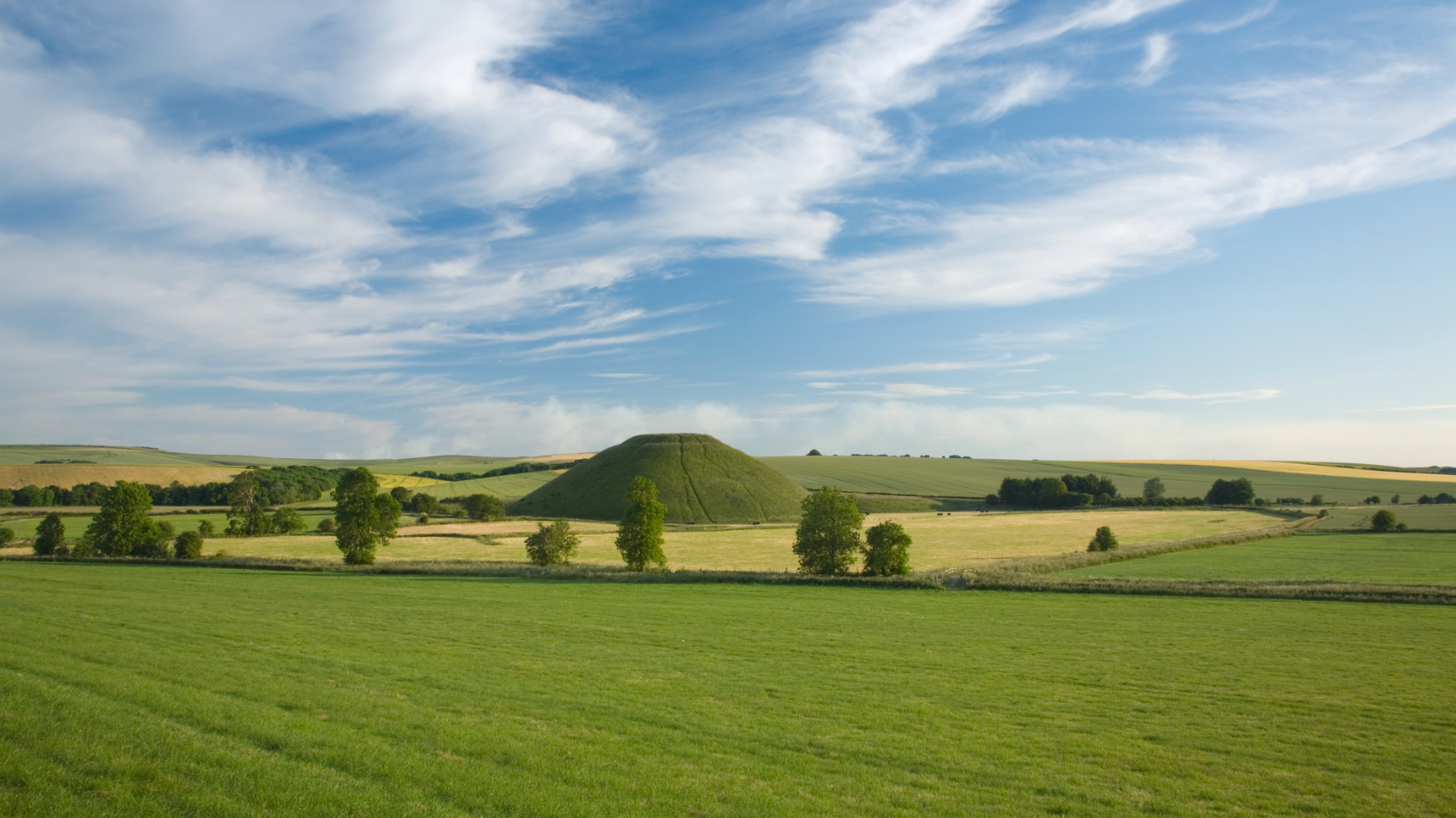
A ‘Tumulus’ (or plural, ‘Tumuli’) is a circular earthen burial mound. They date from the Bronze Age (2400BC–800BC) and are the most common prehistoric monuments in the whole country. Inside the mound there’s usually one central burial – of a corpse or someone’s cremated remains, and often some ‘secondary burials’ of other people, dug into the sides of the mound at a later date.
In upland areas the style of burial was similar, but people built a circular stone cairn over the burial, rather than heaping soil. If your map shows a ‘cairn’ in gothic font, it’s definitely a prehistoric burial mound, even if it’s now used as a walkers’ cairn too. Most people won’t realise they’re walking past a 4,000-year-old grave. They’re protected monuments, so be careful not to disturb them or remove any stones.
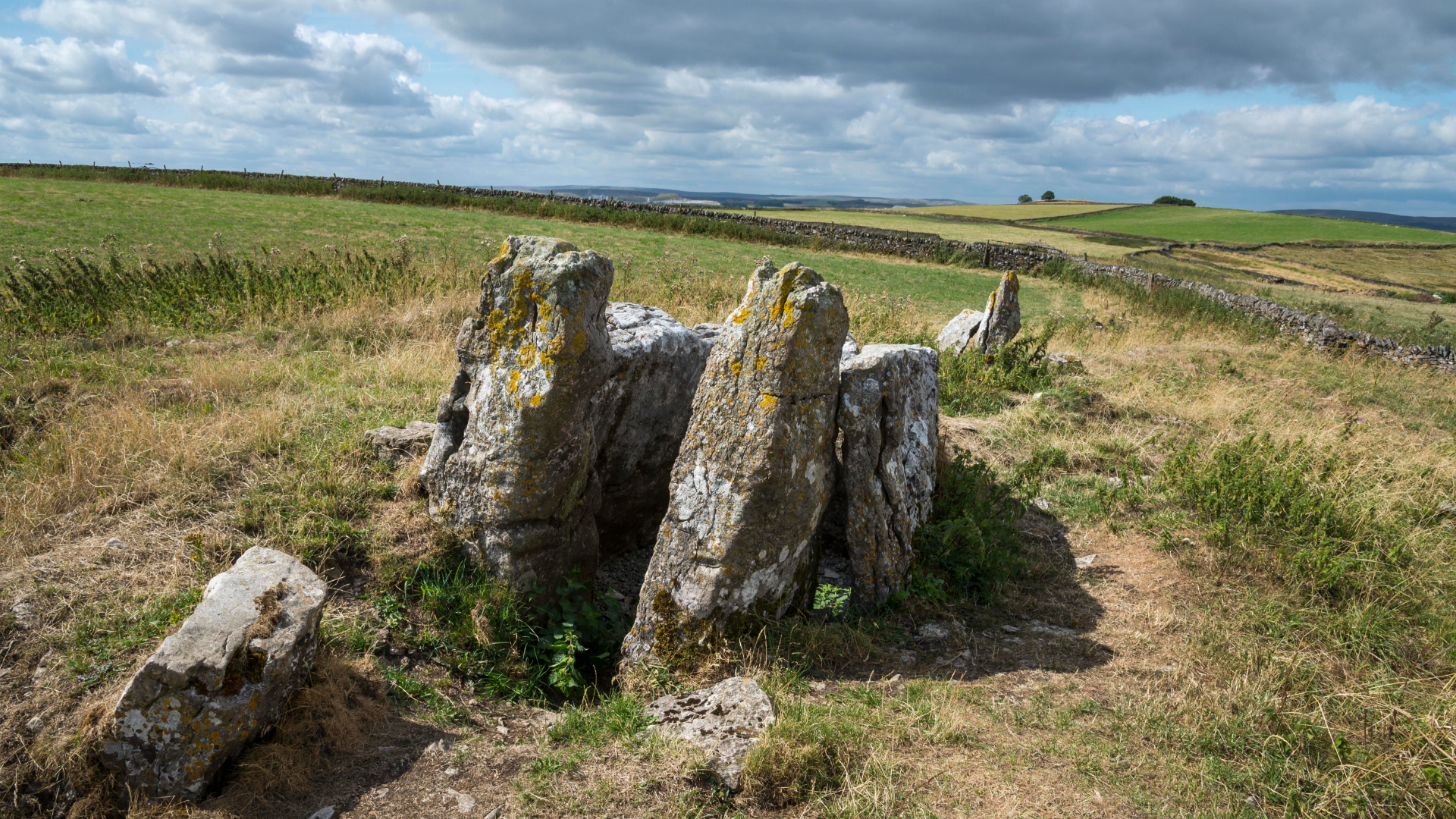
You can also spot earlier burial mounds in the landscape, which tend to be oval or rectangular in shape, rather than round. These are known as long barrows, or long cairns, and they’re from an even earlier period – the late Stone Age, or Neolithic. These were used as communal burial sites and are the oldest monuments you can see in the landscape (more than 1,000 years older than the stones at Stonehenge). Wayland’s Smithy in Oxfordshire, West Kennet Long Barrow in Wiltshire, Gib Hill Barrow in Derbyshire and Cairnholy in Dumfries and Galloway are all fine examples. They are more than 5,500 years old and still standing.
You’ll also spot the remains of other Neolithic communal tombs called ‘dolmens’ or ‘quoits’, particularly in Cornwall and Wales. These are the arrangements of massive stones that used to be in the centre of a burial mound. The earth mound or cairn stones have eroded away but the central stones remain. It’s possible that the horizontal stones at these sites were always exposed, and were once used for laying out dead bodies – perhaps for a form of sky burial, where birds would pick the bones clean before they were put into the tomb.
There are lots of mounds out there – you might also spot burnt mounds of stones that were used in prehistoric times for cooking, or pillow mounds, which are manmade medieval rabbit warrens from a time when rabbits were prized for their fur, rather than considered a pest. There are also the remains of old castles that were built on mounds (‘mottes’).
There are some red herrings too, though – mounds in U-shaped glacial valleys like in the Lake District are more likely to be geological features (created from gravel dumped out of the bottom of a passing glacier) rather than historical mounds.
Other things you might spot

Ridge and Furrow – these are the corrugations in a grassy field that are the remains of medieval ploughing. Look carefully and you might spot a gentle reverse S-shape curve towards the top of the field. Teams of oxen pulling the heavy wooden ploughs were trained to drift left so they could make the turn at the top of the field and begin the next furrow. Many of the fields were abandoned after the Black Death, when survivors could move to more fertile land, or when landowners threw their tenants out in order to make space for more sheep pasture. That’s why the plough marks have survived – they’ve never been ploughed since.
Coppiced trees – this woodland management technique involves cutting a broadleaf tree low to the base and encouraging new shoots to grow up into multiple tree trunks. Beech, hornbeam, hazel and birch are common examples. The technique ensured the tree would live longer, and provide more useable straight timber, from a time when wood was essential for all building work. If a tree has been cut higher up, it’s called pollarding; this was a way to manage trees in areas where cattle or deer would otherwise eat all the new shoots. Ancient hunting forests, where the deer belonged to the king and so couldn’t be harmed or restricted, are perfect places to spot pollarded trees.
Holloways – these ‘hollow ways’ or sunken lanes are usually very ancient – the land surface has been worn away by hundreds of years of feet, hooves and cartwheels following the same route. In some places holloways are probably prehistoric – and many are still in use. When you’re walking on a holloway you’re literally treading in the footsteps of the ancestors. You might also spot lines running across a landscape that show where a path used to be – your detective ears should prick up, as roads always lead to somewhere. So have a look at a map and go exploring if you have access – see what you can find.
Mystic pubs – why not stop at the pub at the end of your day, for a little more historical research? Many rural pubs were old coaching or drovers’ inns, where the horses pulling the stagecoaches could be changed, or where herders could rest overnight with their animals, before continuing their long walk to market. Look out for drovers’ lanes with high hedges and wide verges, and small paddocks that were once used to corral the animals but might now be the beer garden. You’ll also probably spot ranges of stabling, high arched gateways that gave clearance into the yard, and perhaps other surviving horsey features like mounting blocks and tethering rings.
Inside the pub, look for markings etched into wooden and stone windowsills, doorframes and fireplace lintels. You might spot ‘witch marks’ (aka apotropiacs), which people carved to protect themselves from evil spirits. Thresholds and openings to the building were considered particularly dangerous areas. Look out for crossed Vs that form a W shape – these are Marian marks, which invokes the protective power of the Virgin Mary – and Daisy Wheels, where circles have been drawn inside one another, forming a kind of flower-shaped net that would tangle and confuse the malevolent forces. If that all sounds a bit crackpot, ask yourself whether you’re wearing your lucky socks, if you’ve ever thrown a coin in a wishing well or saluted a magpie… we may be rational and scientific in some ways, but in others we’re just as drawn to the mysterious as our ancient ancestors were. Happy history hunting.
A broadcaster and writer specialising in anthropology, archaeology and outdoor adventure, Mary-Ann is the Hillwalking Ambassador for the British Mountaineering Council, and a patron of The Tony Trust. She likes nothing more than tramping across peat bogs to hunt for lost stone circles, and once trapped herself inside a bivvy bag with her dog and almost died. Oops. Her new book, Secret Britain: Unearthing Our Mysterious Past is out now.

