The best navigation apps: find your way in the great outdoors
Our pick of the best navigation apps for route planning, nav during adventures, sharing experiences and inspiration

All the latest inspiration, tips and guides to help you plan your next Advnture!
You are now subscribed
Your newsletter sign-up was successful
1. The list in brief ↴
2. Best for worldwide adventures
3. Best for multi-sport planning
4. Best for finding routes
5. Best for the UK
6. Best for local map layers
7. Best for US National Parks
8. Best for trail runners
9. Best for rock climbers
10. Best for multiple map types
11. Comparison table
12. How we test
13. How to choose
14. FAQs
It's difficult to keep pace with the developments of the best navigation apps. The various platforms are engaged in a technological arms race to provide the best tools and features to hold on to their respective customer bases.
Sometimes the main players move strategically when they like the look of another platform's tech and features. Smaller platforms with loyal followers have been swallowed up by bigger fish. This was was the case with the ever-popular ViewRanger when it was bought out by Outdooractive in 2021, to the dismay of many. In October 2024, the much beloved FATMAP will be fully integrated into the all-conquering Strava. It's unclear how much of FATMAP's former functionality will be carried forward, but it could spell bad news for the rest of the competition if the full potential of this merger is realized.
One thing is for sure, these excellent apps are making the backcountry more accessible than ever and are a real boon to any adventurer, becoming as essential as carrying a waterproof jacket on your escapades. To help you choose the best navigation app for your projects and planned trips, we asked our hiking experts to break down your options.
The quick list
This is the quick list, showing a brief overview of the apps in our selection. For a more detailed look at these excellent platforms, navigate further down this guide.

With a good standard map layer, as well as many topographical maps that can be used across the world, Gaia GPS is a great choice for globetrotting adventurers

With its social features, map layers for different sports, great usability and loads of user-generated content, komoot is a superb choice for a range of adventure styles
The award-winning AllTrails is an excellent choice for discovering routes in new regions, complete with user reviews and other useful information

The OS Maps app takes the detailed UK Ordnance Survey topographical maps and puts them in the palm of your hand, though route planning could be better

Like Gaia, Outdooractive boasts great usability alongside an impressive library of topographical maps, giving you excellent navigational tools no matter where you are
While use is limited to US National Parks, this wonderful free app is a no-brainer for those exploring the American backcountry, with a huge range of features beyond nav
Load the next 3 products ↴

The all-conquering app is used more for activity tracking then navigation but with the takeover of the magnificent FATMAP, it's one to keep an eye on when the integration is complete

With offline 3D maps designed for hikers, backcountry skiers, mountain bikers and rock climbers, onX Backcountry is a very interesting proposition

The Avenza app goes beyond outdoor use, allowing you to buy and download a wide variety of maps from the Avenza Store
The best navigation apps 2026
You can trust Advnture
The best navigation app for worldwide adventures
Gaia GPS
Our expert review:
Specifications
Reasons to buy
Reasons to avoid
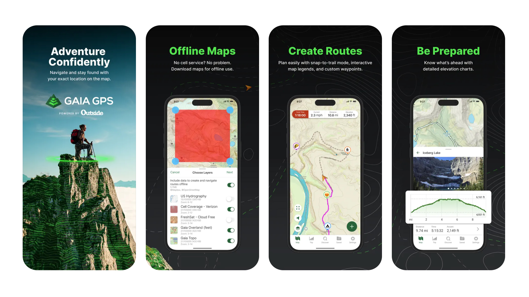
The standard free version of Gaia gives you the ability to navigate, create routes and record activities using the platform's basic Open Street Map layer. Visually, it's better than some of its competitors when it comes to mountain adventures, with clear contour lines and shading that bring the landscape to life. The route planner is easy to use and powerful, though quickly finding and selecting popular routes isn't as easy as on platforms like AllTrails or komoot.
Gaia's main strength is the range of over 300 topographical maps that are accessible with a Premium subscription. These include USGS and USFS topos, as well as many great European maps too. They can also be layered on top of each other for a customized view.
The basic tools are free to use, though for offline use, weather & terrain features and the more advanced topographical maps, you'll want a Premium subscription. However, if you're a member of Outside+, you get Gaia's Premium features as part of the package.
The best navigation app for multi-sport planning
komoot
Our expert review:
Specifications
Reasons to buy
Reasons to avoid
Komoot has been rapidly growing in popularity over the last few years and, having conquered Europe, is now expanding its US focus. In 2024, it announced it had reached the milestone of 40 million users worldwide.
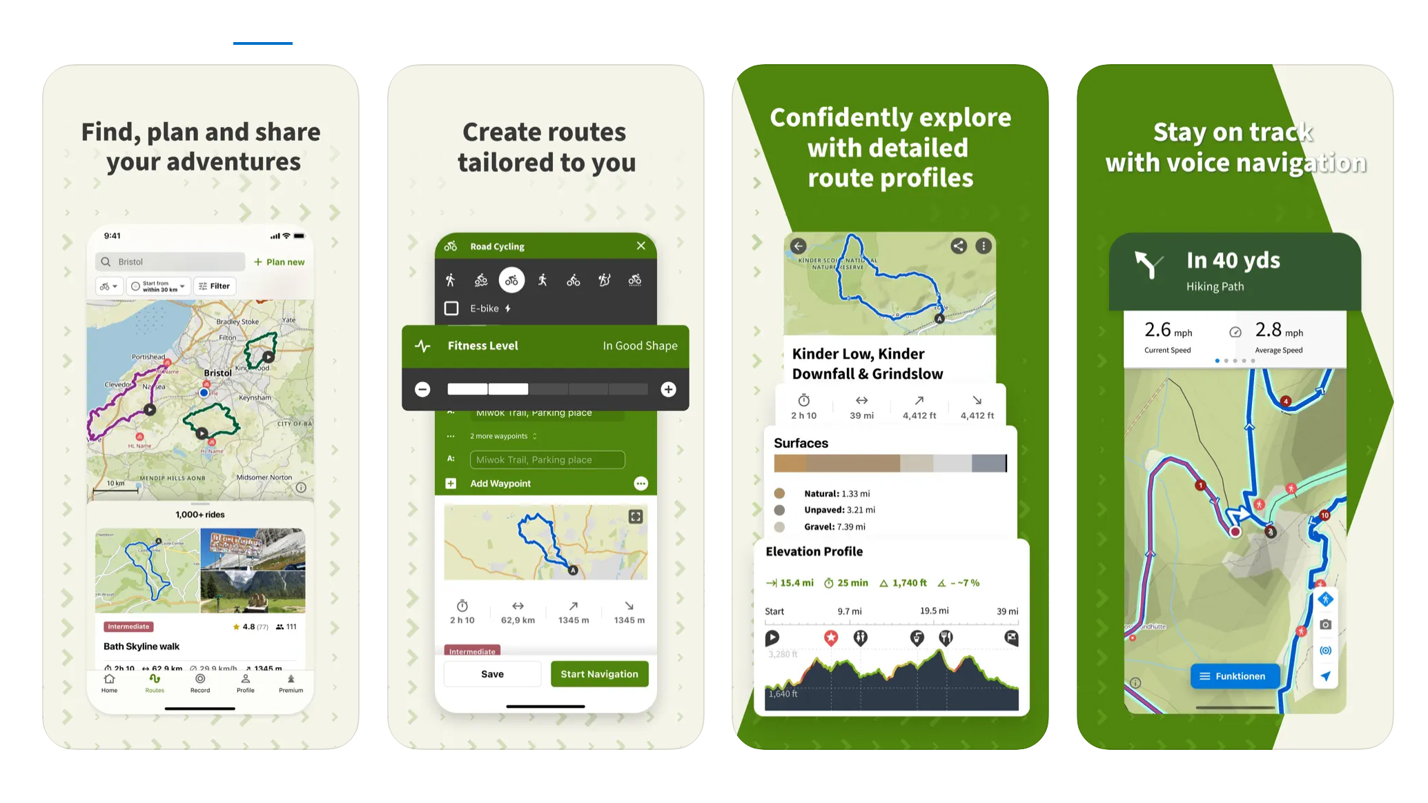
It’s arguably better for pedallers than plodders, but the redeeming feature is that it can be the best friend of a lazy planner, as you can simply pop in the start/finish location for your chosen adventure and it will work out a suitable route for you based on your selected sport type – with options on paths, roads or trails. It's also great for quickly finding popular routes in your chosen region.
The maps are based on OSM and are relatively straightforward, nowhere near as detailed as a topo map for serious hikers and mountaineers. Unlike some platforms, komoot doesn't support additional regional map layers. The free version gives you basic functionality, while you can buy regions for offline navigation or you can buy the whole world in a single one-off payment. A Premium subscription opens up advanced features like live tracking, sport-specific maps and the ability to use the komoot map on a Garmin device.
Navigationally it provides turn-by-turn directions. Of particular use is that they highlight routes suitable for road/mountain biking as well as cycle touring, and allow you to see what sections of the road are paved and which are dirt tracks. Part of its popularity is down to the the social media/community aspect, as users are encouraged to log in and highlight favoured spots and make recommendations, which definitely adds value to the user experience and makes it one of the best navigation apps you can download today.
The best navigation app for quickly finding popular routes
AllTrails
Our expert review:
Specifications
Reasons to buy
Reasons to avoid
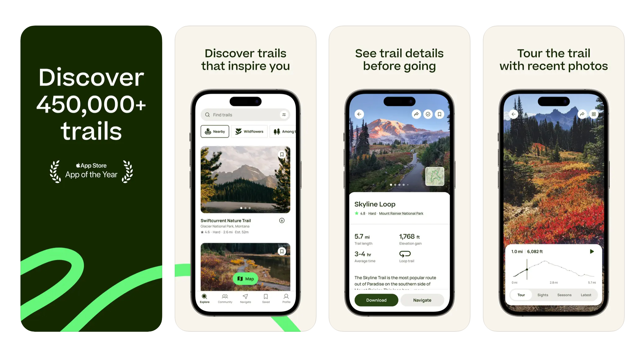
If blazing your own trail is not what you’re about, and you’d sooner follow ready-made routes that are tried and tested, then AllTrails is a great option.
The free version allows you to search the database (there’s over 400,000 featured trails) to find a whole host of hikes close to wherever you find yourself – including dog-, wheelchair- and stroller-friendly options, which all come with distance, elevation and timings as well as (handily) images and reviews, not to mention a function to be directed (via Google Maps) to the start of the walk, and a quick weather forecast too.
You can also write and submit your own route if you want to share your favorite strolls. AllTrails+ provides offline maps, alerts you when you make a wrong turn, allows you to live share your activities, preview your route with 3D flyovers and gives access to over 200 guides.
It’s one of the best navigation apps for when you find yourself in an area you are not familiar with, though the level of mapping detail means it isn't ideal for the mountains. At the moment, you can also buy AllTrail+ and a National Park Annual Pass Bundle for $99.
The best navigation app for the UK
OS Maps
Our expert review:
Specifications
Reasons to buy
Reasons to avoid
You can’t think about maps of Britain without picturing the ubiquitous orange and pink folded gems of the Ordnance Survey 1:25,000 (Explorer) and 1:50,000 (Landranger) charts, respectively. Still the tool of choice for any orienteering training, it’s good to see that OS has moved with the times and made an app available on your phone. Revamped in early 2024 and with 5 million users worldwide, is it as good as its paper counterparts or its arguably more digitally savvy, international app rivals?
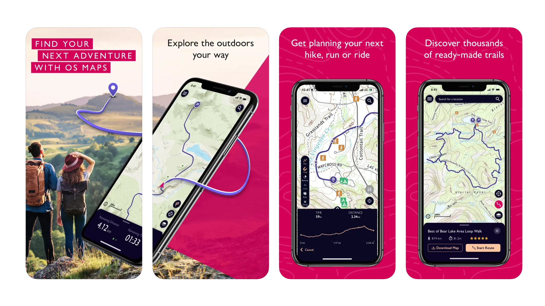
The free version of OS Maps – which includes basic mapping and sharing, creating and printing routes – is OK, but not really detailed enough on the ground. The free route planning tool is a little bit cumbersome and doesn't automatically snap to the trail like on other platforms.
However, once you pay the annual subscription, the entire range is at your disposal – in all scales – meaning you can plot, share and follow a route, for walking, running and cycling anywhere in Britain and download it to your phone, then track your position once there.
It also unlocks a 3D Tabletop rendering to give you a good idea of the terrain you’ll encounter as well as a nifty augmented reality option so when you stand on a summit you know exactly what you are looking at. The brand new home tab is a big improvement, giving users for personalized information and route suggestions when they open up the app.
The best navigation app for local map layers
Outdooractive
Our expert review:
Specifications
Reasons to buy
Reasons to avoid
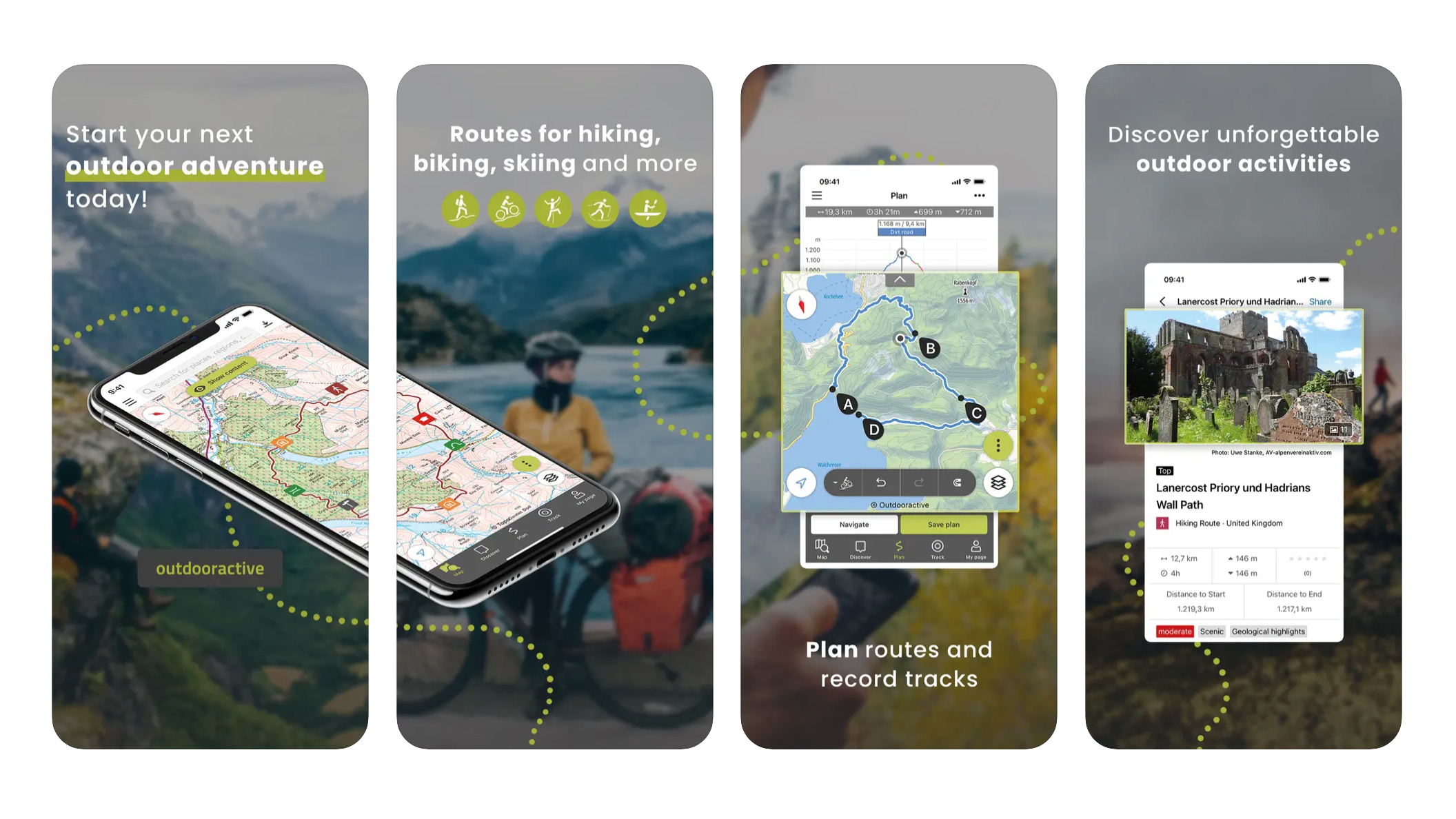
Like komoot, Outdooractive is a German product that offers route planning and navigation capability for a range of outdoor pursuits, from hiking and mountaineering to road cycling and mountain biking. The company bought the popular Viewranger in 2019 and the teams have been working together to optimize the platform going forward.
Outdooractive is chock full of route suggestions from Sunday strolls to epic alpine adventures, making it one of the best navigation apps for exploring new locations. Like komoot, the community plays a big part and you can share your routes and suggestions. One big plus is the inclusion of regional topographical map types, such as Harvey Maps in Britain or Alpine Club maps in the Alps, which are much more detailed than what you tend to find when using maps that used Open Street Maps as their base. However, to access these you do require the Pro or Pro+ subscription. There are also Travel Guide pages where you can read exciting stories and travelogues from expert writers.
There are three membership levels. Basic is free and gives you the option of planning and navigating routes, as well as the ability to download GPX files. You can also rate and review routes and accommodation. Pro is $34.19 (£26.69) per year and gives you access to the regional topo maps, enables you to use maps offline, plus a range of other feature and even discounts with the likes of Aku, Garmin and Helly Hansen, among others. Pro+ is $68.39 (£53.39) per year and gives you access to an even wider range of detailed topo maps, such as the excellent Harvey maps in the UK; allows you to embed your routes onto your website or blog; and features 3D maps.
The best navigation app for US National Parks
National Park Service
Our expert review:
Specifications
Reasons to buy
Reasons to avoid
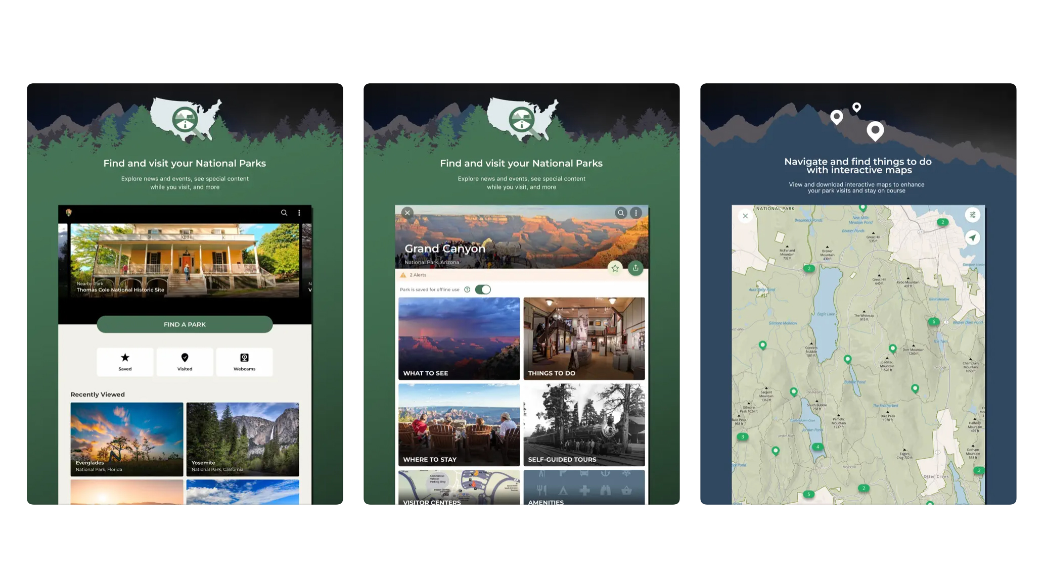
For those heading out to explore America's national parks, the National Park Service (NPS) app is the best navigation app by far. It features a wealth of features that go way beyond navigation. There's information about local amenities, access to webcams, lodge reservations, suggested itineraries, restaurant bookings and even virtual postcards so that you can share your experiences with family and friends. Best of all, the app is totally free!
Of course, any hiking app worth its salt will be judged by its maps. The NPS app's are detailed, interactive and user friendly. Most importantly, they work offline too, which is great if you're concerned about signal in remote areas or data usage. Having all the national parks in one handy app is a real game changer. The National Park Service are adding features all the time so, while the app is already great, it will only get better.
The best navigation app for trail runners
Strava
Our expert review:
Specifications
Reasons to buy
Reasons to avoid
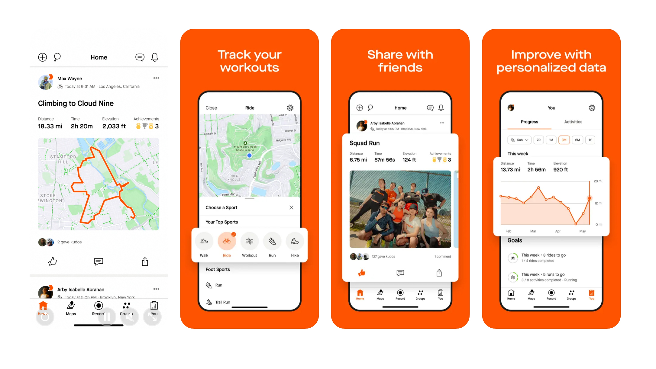
Strava, the all-conquering app that boasts over 120 million users, is better known for tracking workouts and giving fellow athletes kudos than it is for route planning and navigation. The free offering is very basic where backcountry adventures are concerned. However, subscribers can use its route planner to plan runs, hikes and bike rides etc and, in fall 2024, FATMAP will be integrated into the platform.
This is a big deal. Before FATMAP was swallowed up by Strava, it had a loyal following of 1.6 million users and was highly rated as one of the finest adventure apps around, particularly with regard to its high-res 3D mapping, seasonal map layers and curated content. Mountaineers and backcountry skiers adored its functionality and its was this fast-growing reputation that obviously attracted Strava to move on in.
So, while much of Strava's functionality as a navigation app for hikers is hidden behind the need for users to subscribe, if it gets its FATMAP integration right – and it's a big if – it may become the ultimate platform. Watch this space.
The best navigation app for rock climbers
onX Backcountry
Our expert review:
Specifications
Reasons to buy
Reasons to avoid
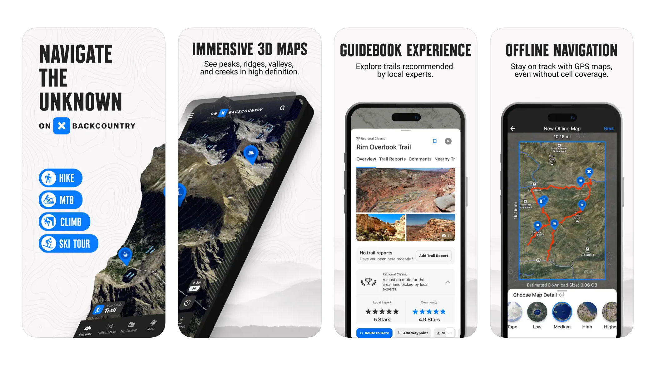
Championed as being "built for adventurers, by adventurers", onX Backcountry brings mapping and curated content together in a package that's very appealing, particularly to US users. With 24k topo for the entire US, satellite, hybrid and 3D views, the map interface is smart, while the mapping is linked to expert-curated content from companies like Beacon Guidebooks and groups like Colorado Mountain Club.
There are modes for hikers, backcountry skiers, mountain bikers and rock climbers. Particularly impressive is the range of curated content, with over 4,000 backcountry ski lines with guidebook descriptions and over 300,000 rock climbing routes and approach trails.
If this all sounds too good to be true, a major drawback is that it's only available for free as a 7-day trial, after which you'll be paying for Premium, albeit at a heavily discounted rate for the first year. The very expensive Elite mode gives full access to the guidebook quality content, as well as info on private land and recent satellite imagery that reveals local snow conditions. Elite members also get discounts from selected brands, such as Mammut and Backpacker's Pantry.
The best navigation app for multiple map types
Avenza
Our expert review:
Specifications
Reasons to buy
Reasons to avoid
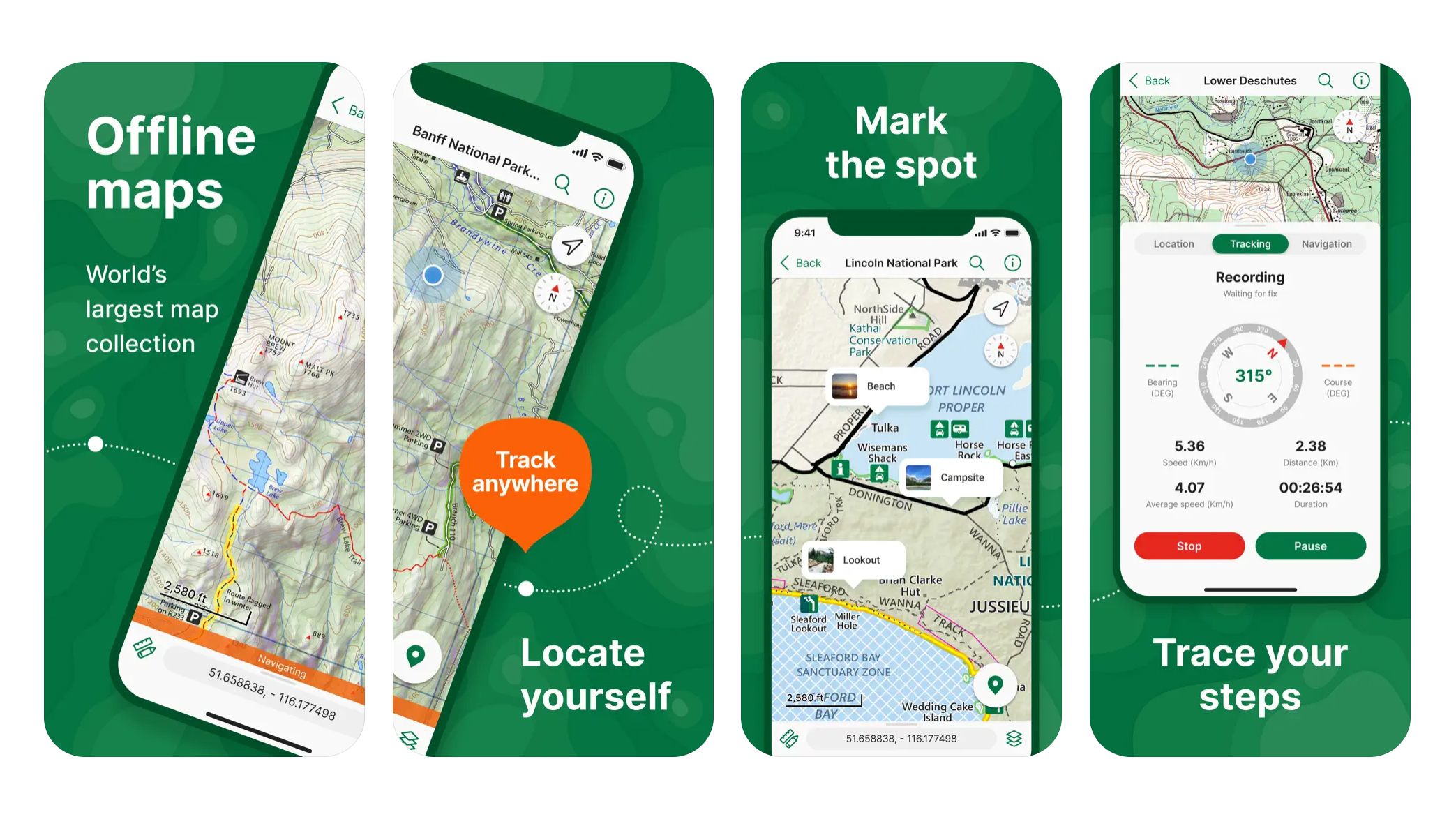
Less of a platform in itself and more of a store from which to purchase and store the maps you need, Avenza is an intriguing proposition. Useful for more than just outdoor adventures, you can purchase city maps, regional topographic maps, offroading maps, hunting maps, fishing maps... the list goes on. You can search for maps based on location, adding them to your library and the range is extensive, including USFS, USGS, National Geographic, HarperCollins, National Park Service and Harvey, just to name a few and there are thousands more.
The app uses your phone's GPS to accurately track your location offline on whichever map you've downloaded, allowing you to navigate accurately. You can add place marks to your chosen map, add notes and photos to any location, measure distances and estimate timings.
There are various pricing options beyond the Free version, which gives you basic functionality and the ability to import up to 3 maps at a time. The Plus subscription enables you to create and manage geofences, access the satellite basemap layer and import up to 20 maps at a time. Pro and Enterprise are more sophisticated and are aimed at businesses and government.
Comparison Table
App | Price | Main pros | Main cons |
Gaia GPS | Basic: Free; Premium: $59.90 per year; Outside+: $89.99 per year | Great range of quality worldwide topo map layers and excellent functionality | Lacks the community features of some and not great for quickly finding popular routes |
komoot | Basic: Free; per map: $3.99 (£3.99); World Pack: $29.99 (£29.99); Premium: $59.99 (£59.99) | Excellent functionality, great for both plotting and finding routes and strong social media elements | Mapping a little basic compared to some |
AllTrails | Basic: free; AllTrails+: $35.99 (£35.99) per year | Easy to use, looks great and makes finding popular routes very easy | No route creation on mobile and maps not as detailed as some |
OS Maps | Basic: free; Premium £34.99 per year or £6.99 per month | Unrivalled detail for the UK and great 3D features | Route planning in free version is cumbersome and it's only very good for UK users |
Outdooractive | Basic: free; Pro: $34.19 (£26.69) per year; Pro +: $68.39 (£53.39) per year | Great range of quality worldwide topo maps and product discounts for Premium members | Unattractive interface and it's better suited to users in mainland Europe |
National Park Service | Free | Superb level of detail on US National Parks and totally free to use | Only suited to US National Parks |
Strava (FATMAP) | Basic: Free; Subscription: $79.99 (£54.99) or $139.99 (£99.99) for a Family Plan | Excellent tools for tracking performance and fitness and the potential of the integration with FATMAP | Free version doesn't allow route planning and it's unclear if all of FATMAP's revered features will remain |
onX Backcountry | Premium: $9 for first year then $29.99; Elite $30 for first year then $99.99 | Find curated adventures for climbers and skiers as well as hikers and mountain bikers | No free version and most content suited to the US |
Avenza | Basic: Free but individual maps cost varying amounts; Plus: $39.99 per year; Pro: $159.99 per year; Enterprise: special pricing | A one-stop shop for loads of high quality maps that can be used offline | No route planning and could end up being very expensive |
How we test the best navigation apps
We test each navigation app in the backcountry, testing its route finding, planning, navigation, third-party integration and post-activity features to the full, while considering usability, the range of features and value for money.
For more details see how Advnture tests products.
Meet the testers
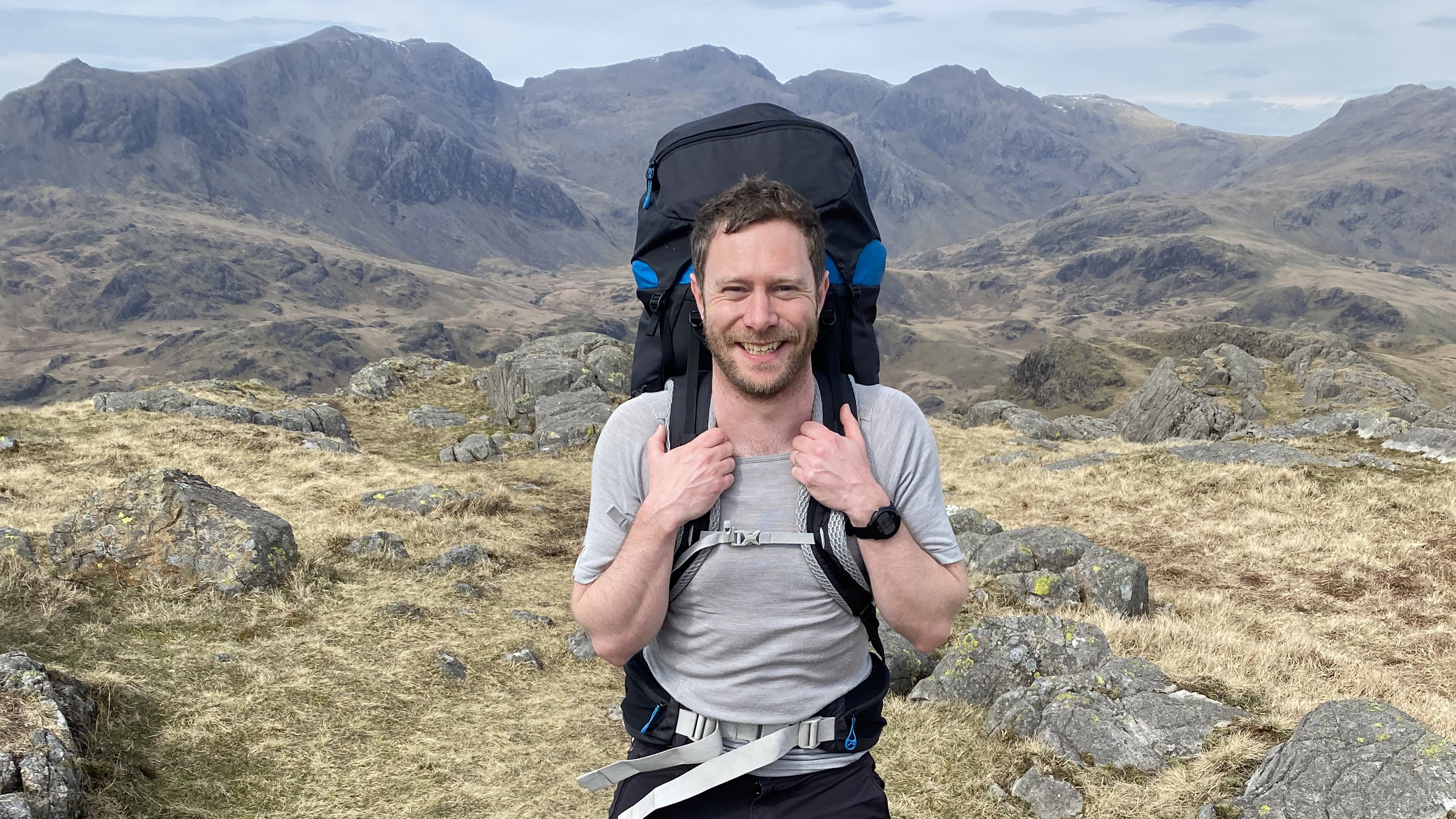
Alex is a qualified UK Mountain Leader and an advocate of using digital tools alongside traditional navigation techniques. He has been using hiking apps for many years for his trail running, hiking, mountaineering and climbing adventures.

Our former Editor-in-chief Cat is passionate about both tech and the outdoors. She's an expert on all things GPS watches and navigation apps and brings her knowledge to bear here. These days, she's the Homes Editor at TechRadar.
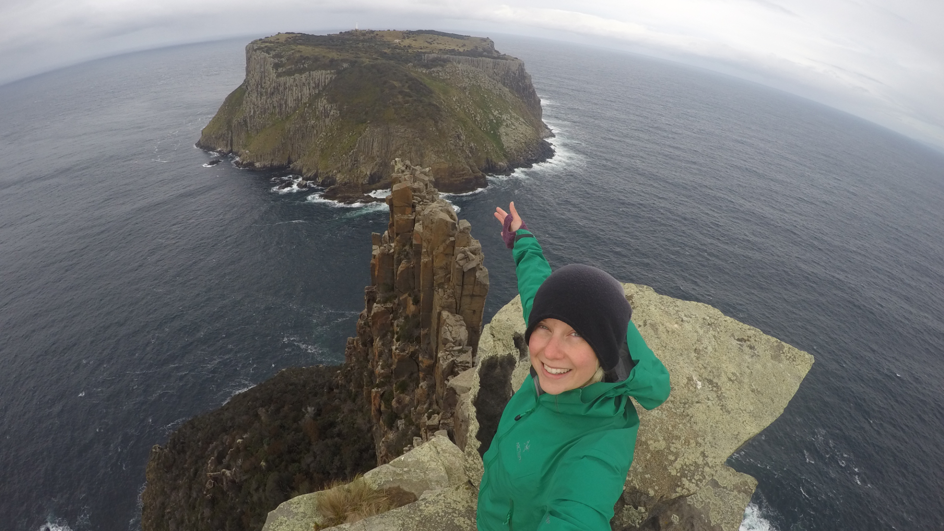
Phoebe is an award-winning travel and adventure writer, photographer, broadcaster and author of 10 books about the outdoors. She's the first person to have slept at all the extreme points of mainland Britain, solo on consecutive nights. She's no stranger to using navigation apps to find her way in the backcountry.
How to choose the best navigation app
Route planning
Some of the best navigational apps have powerful route planning tools, meaning you can dream up your ideal hike, plot it using the platform and get an idea of things like how long it will take you and even how many calories you can expect to burn. Many work in tandem with a desktop version and you can usually download your planned routes as a GPX file, which will be compatible with other platforms and GPS devices.
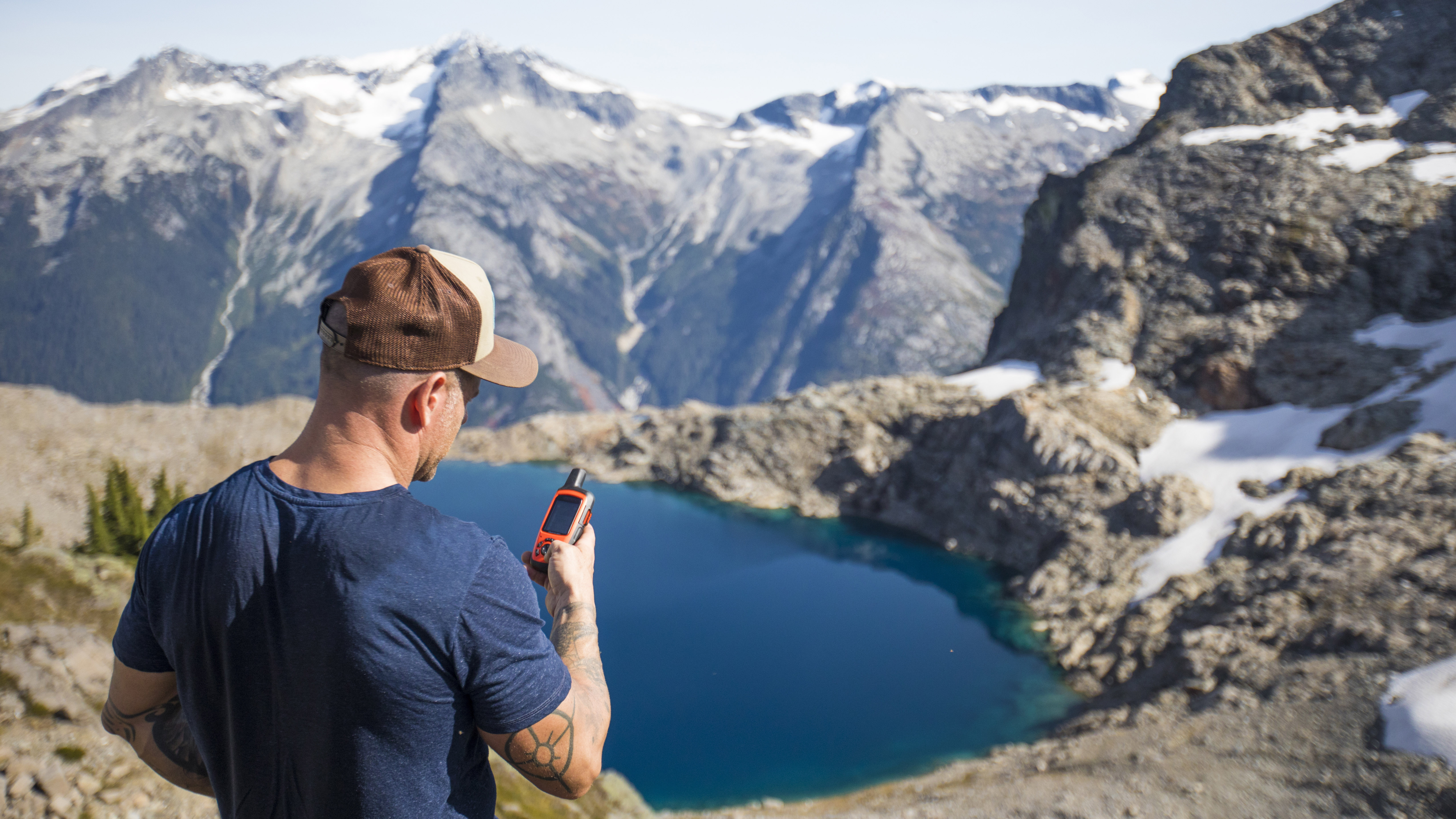
Live tracking
You can alleviate the worry of your friends and family by allowing them to live track your movements. Of course, this means you will all have to be on the same app platform, but this is an excellent safety net that means you'll never go missing without a trace (as long as you have battery). This is also great if you're taking on a big peak-bagging challenge or a ultra run, as your friends can track your progress.
Social media sharing
'If it's not on Strava it didn't happen' has become something of a saying in the online running community. With apps like komoot providing a fun and easy to share your adventurous exploits on social media, the same could be said of hiking these days. After a walk, the best hiking apps allow you to share your photos, your thoughts, your personal highlights and create your own content for the platform, giving you a great sense of ownership. You can label other people's contributions as useful or not useful and get inspired by each others' antics.
Multi sports
These days, many apps offer sport specific maps and features. After all, what's useful for a speedy road cyclist is different to what's useful for someone who's loaded up like a mule on a thru-hiking expedition. Some platforms now offer voice navigation, which is tremendously useful for fast pursuits like cycling, mountain biking and trail running, where you don't want to be looking at a map every time you reach a junction.
FAQs
Can you rely on navigation apps alone?
Navigation apps are improving all the time and the ability to track your exact location, while sharing it with friends and family is invaluable.
However, technology is fallible and batteries can die. We would always recommend also carrying a map and compass and knowing how to use them, as well as having a navigational app. It's also a good idea to bring a power pack so that you can charge your phone, should it be running out of juice.
We'd say using a blended approach of hiking tech and traditional map and compass is the best.
Should I use Google Maps for hiking?
No. While Google Maps does show some hiking trails, it is not recommended for use as a hiking app. It doesn't show the level of detail you need to navigate effectively, such as contour lines. Further to this, it may recommend routes that take you into dangerous technical terrain, which it made global news for after leading hikers up a hazardous route on Ben Nevis, Britain's highest mountain.
Do I need a GPS device or can I just use my phone?
These days, a smart phone is a perfectly good navigational tool, as long as you are using a high-quality, dedicated hiking app. The ability to see your location on a topographical map in real time is a marvel that explorers of old would have been amazed by.
What is Open Street Map?
The foundation of many of the best navigation apps is Open Street Map (OSM). You can think of OSM as being like the Wikipedia of the digital mapping world, a platform that can be edited by anyone. This means you can sign up to the platform and add or make changes to any features on the map, such as trails, cliffs or parking spaces, for example.
It's a powerful tool and each map feature is backed up by data. For example, when working on a trail or road, information about its difficulty and suitability for different vehicles can be added, as well access information. Navigation app creators take all this data and apply it to their platform in a way that best suits their users.
Are there disadvantages to Open Street Map?
The relatively loose verification of changes made by users on OSM means that it can be unreliable. Trails can be inaccurate or additional data that's added can be wrong. However, both OSM and the apps that use it give users the ability to report issues that need corrected.
Also, OSM is, in effect, still being built, so not all the world's trails even appear on it. Meanwhile, some regions are much more accurately mapped then others.
There has been controversy surrounding navigation apps and their use of OSM in recent years. In the UK, Mountain Rescue reported multiple cases of hikers becoming unstuck having unwittingly plotted potentially dangerous routes. This happened because the app in question displayed all potential routes in the same way, whether they're an easy-to-follow footpath or a technical scramble. Some apps, like komoot, display more dangerous trails with a dotted line and a difficulty rating, while the platform also warns you if you plot a route that contains potentially hazardous terrain.
All the latest inspiration, tips and guides to help you plan your next Advnture!
Alex is a freelance adventure writer and mountain leader with an insatiable passion for the mountains. A Cumbrian born and bred, his native English Lake District has a special place in his heart, though he is at least equally happy in North Wales, the Scottish Highlands or the European Alps. Through his hiking, mountaineering, climbing and trail running adventures, Alex aims to inspire others to get outdoors. He's the former President of the London Mountaineering Club, is training to become a winter mountain leader, looking to finally finish bagging all the Wainwright fells of the Lake District and is always keen to head to the 4,000-meter peaks of the Alps. www.alexfoxfield.com
- Phoebe Smith
- Cat EllisFormer editor

