What are grid references? The traditional way of describing your location
What are grid references? Learn what a grid reference is and how to read one to describe your approximate location on a topographical map
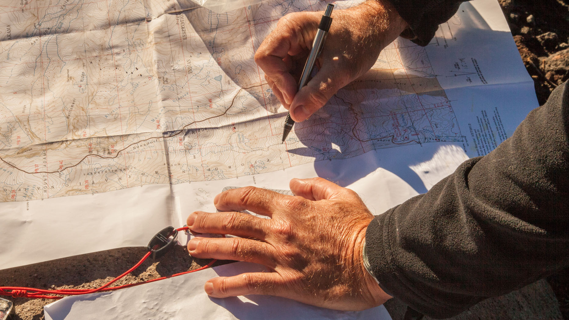
What are grid references? In this age of digital navigation, it’s no surprise that many ask. The availability and quality of digital mapping applications and GPS units have changed the way we navigate and pinpoint our location, while platforms like what3words threaten to make traditional grid references extinct.
However, knowing how to read grid references is still an essential skill in the great outdoors. Grid systems are a mainstay of topographical maps, and appear on many of the best navigation apps too.

With grid references, GPS co-ordinates and platforms like what3words at your disposal, you’ve got myriad ways of communicating a precise location to a third party. At Advnture, whenever we shoulder our best hiking backpack and hit the trails, we like to have a backup to technology, just in case of situations like failing batteries or a dropped phone or GPS unit. When it comes to describing location using a topographical map, grid references are key.
Once you understand how to read grid references, you can use your best compass to get an increasingly accurate numeric representation of a location. This knowledge could be crucial in an emergency, allowing you to effectively communicate your location to rescue services.
What are grid references?
So, what are grid references exactly? Put simply, a grid reference is a numeric representation of a location on a map. Cast your mind back to that treasure map when you were studying co-ordinates at school. When you were figuring out the numeric representation of that buried treasure, you were reading its grid reference. X marks the spot. The minor difference between co-ordinates and grid references are that co-ordinates are where the lines meet and grid references can be anywhere on or between the lines.
In the real world, it’s unlikely you’re going to go on a Goonies style adventure and read grid references to discover a pirate’s priceless hoard. Much more likely you’ll be using them to describe a location on a map. If you ever had to call mountain rescue, being able to supply an accurate grid reference for the location of a person in need will make a huge difference to the rescue effort.
What are grid references like around the world? Well, different nations have their own grid systems. The US National Grid (USNG) and the British Grid System work off the same principles, breaking the entire country down into metric squares, with grid lines orientated along the cardinal points of the compass.
All the latest inspiration, tips and guides to help you plan your next Advnture!
Using Britain as an example, each 100 x 100km square has a two-letter identification. Each of these lettered squares is then broken into a 100 x 100 grid, with each square within the grid representing 1km.
The lines that make up the grid are called Eastings (the horizontal lines running east to west or vice versa) and Northings (the vertical lines running north to south or vice versa). On a topographical map, each of these lines is numbered sequentially from west to east and south to north respectively. Using this information, you can give a four-figure grid reference for a location.
How to read grid references: four-figure grid references
A four-figure grid reference describes the location of something to within a square km, so it’s ideal for big landmarks but not quite as useful for describing the location of smaller things like people or buildings.
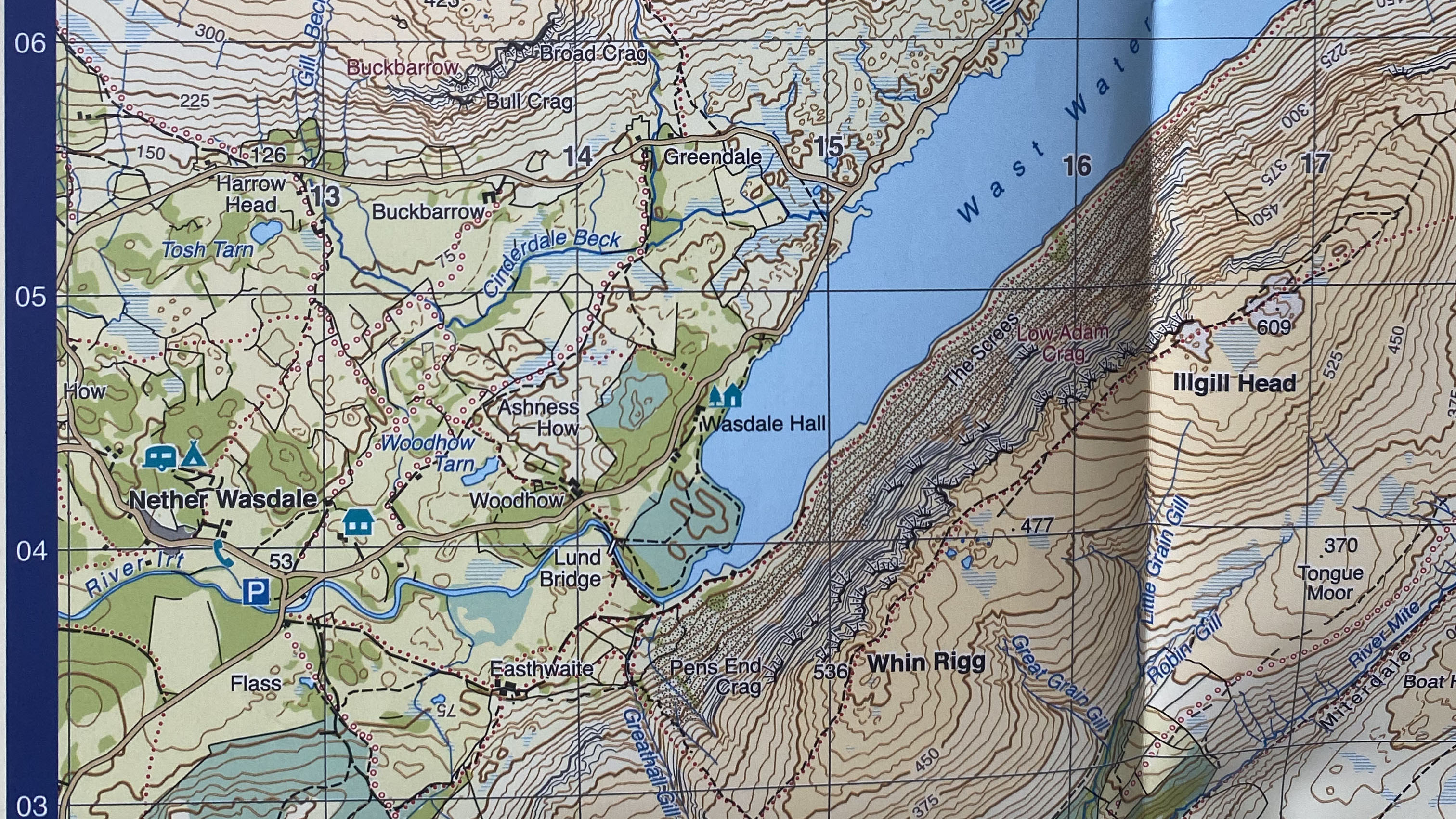
Using the above map as an example, a four-figure grid reference is appropriate for describing the southwestern end of Wast Water, or to describe the location of the hill Whin Rigg’s main bulk. If we wanted to describe the location of smaller features, like Wasdale Hall or Lund Bridge, we’d opt for the greater accuracy of a six-figure grid reference. More on that in a second…
To find the grid reference, start with the horizontal reading (Eastings) and then the vertical (Northings). Another way of putting this, as has been repeated countless times in school classrooms, is along the corridor, then up the stairs.
The grid lines are labelled around the edge of the map, as well as more subtly at intervals within the map (this can be seen on the Eastings lines between the Northings lines 04 and 05 in the image above). Always remember that the numbers refer to the square diagonally to the right (east) and upwards (north) of the line. So, if your feature is between lines 13 and 14 when reading horizontally, its Eastings reference is 13. If your feature is between 25 and 26 when reading vertically, its Northings reference is 25.
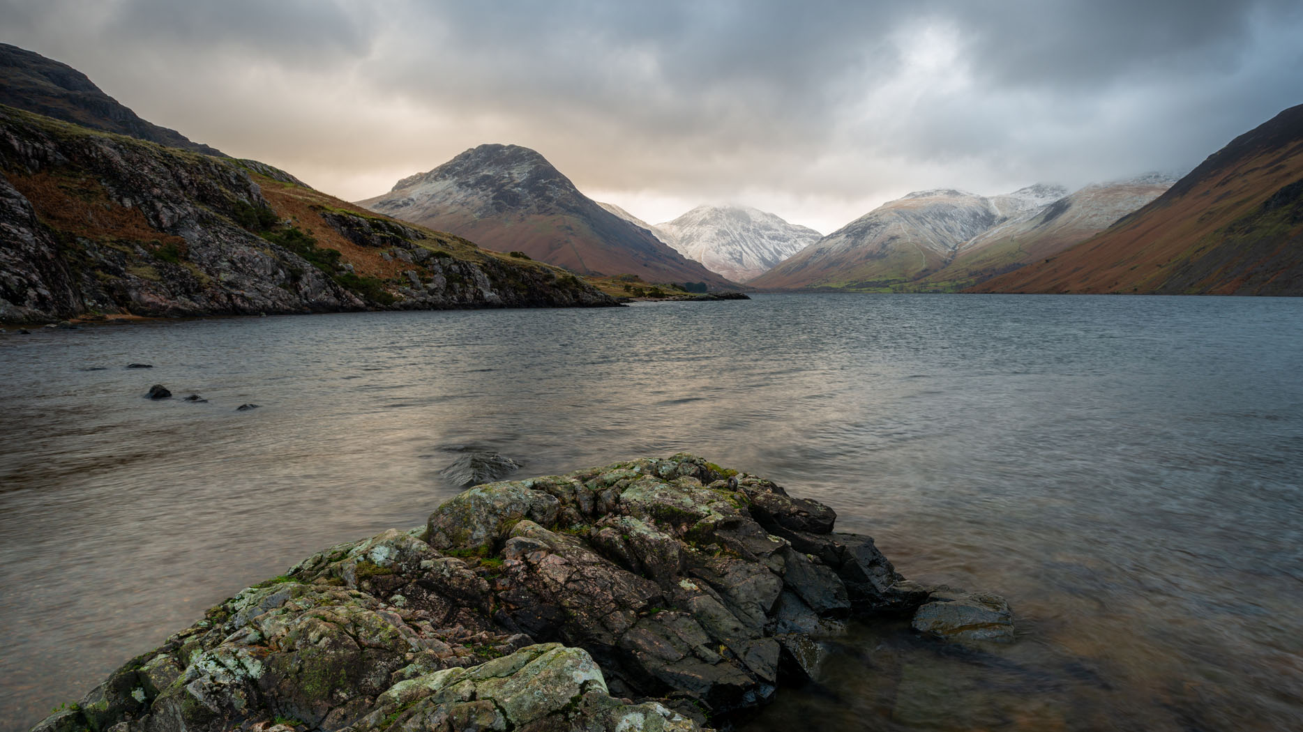
Let’s use the example of the southwestern end of Wast Water in the image of the map above, which is in the NY 100 x 100km square of Britain.
First, read along the corridor: it’s between 14 and 15, so its Eastings reference is 14.
Next, go up the stairs: it’s between 04 and 05, so its Northings reference is 04.
Put all of that together and you get a four-figure grid reference of NY 14 04, which describes the square km that contains the southwestern end of Wast Water.
How to read grid references: estimating six-figure grid references
A six-figure grid reference describes the location of something to within 100 square meters. This is the level of accuracy you’ll want when describing the location of a stricken individual to mountain rescue. On a standard topographical map, there are no lines beyond those that are spaced 1km apart to help you achieve this level of accuracy, so you either have to estimate or use your compass Romer.
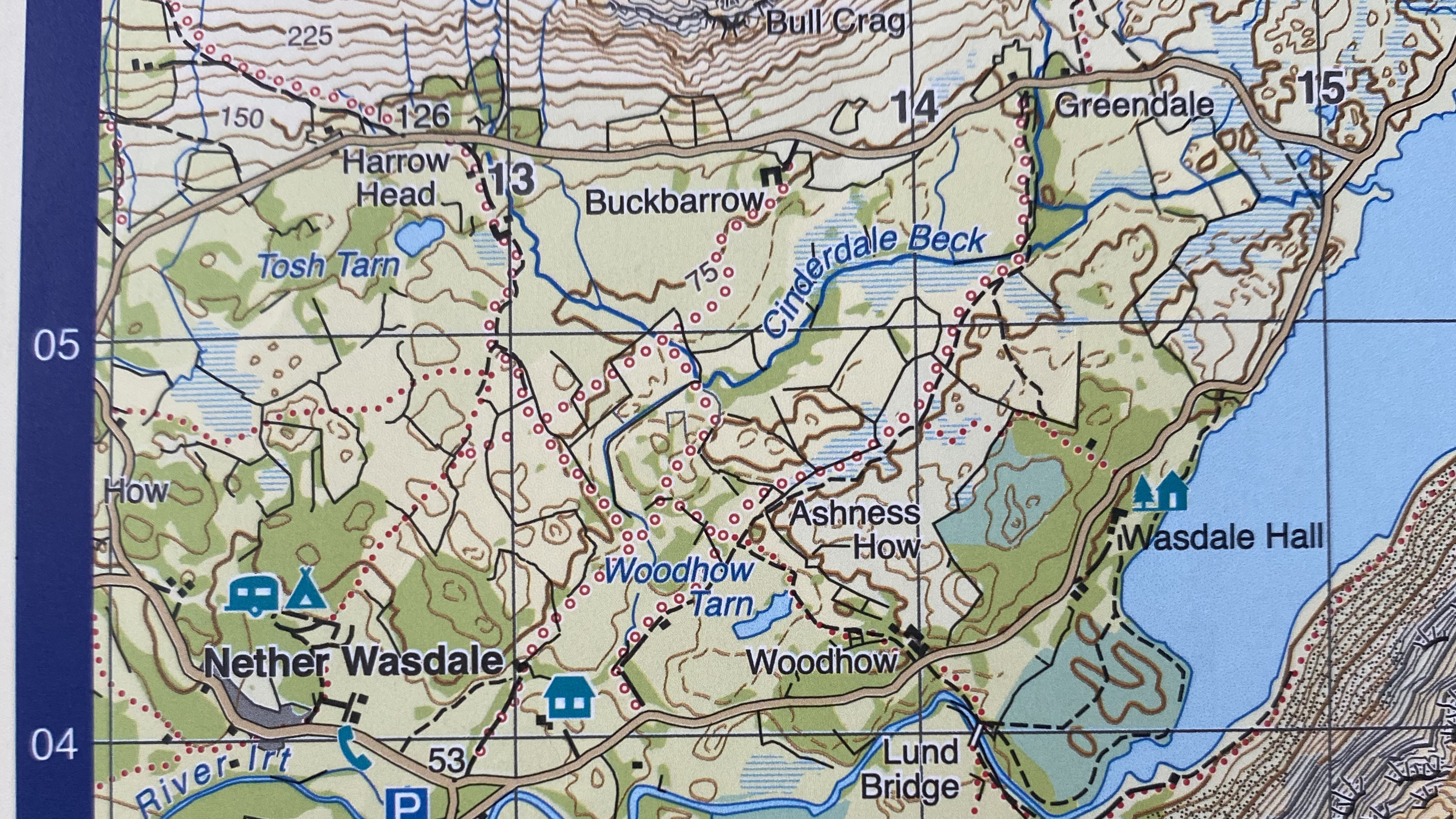
Let’s use Wasdale Hall as our example and find its six-figure grid reference. We already know its four-figure reference is NY 14 04 but we can describe both its Eastings and Northings reference with even more accuracy. Let’s estimate first…
Again, start by estimating along the corridor and imagine splitting the space between line 14 and line 15 into 10 more intervals (each representing 100m). Wasdale Hall looks as though it is exactly halfway between the two lines, so it would be on imaginary line 5. So, the Eastings reference is now 145.
Next, go up the stairs. Once again, Wasdale Hall looks about halfway between lines 04 and 05, so that would put it on imaginary line 5. The Northings reference is 045.
All put together, the six-figure grid reference for Wasdale Hall is NY 145 045.
Now you know how to read grid references, you can go beyond six figures, breaking down the map into increasingly smaller squares (10m, then 1m, then 10cm, then 1cm and so on). However, when using a large-scale topographical map, it is unusual to go past a six-figure reference.
How to read grid references: six-figure grid reference using a Romer
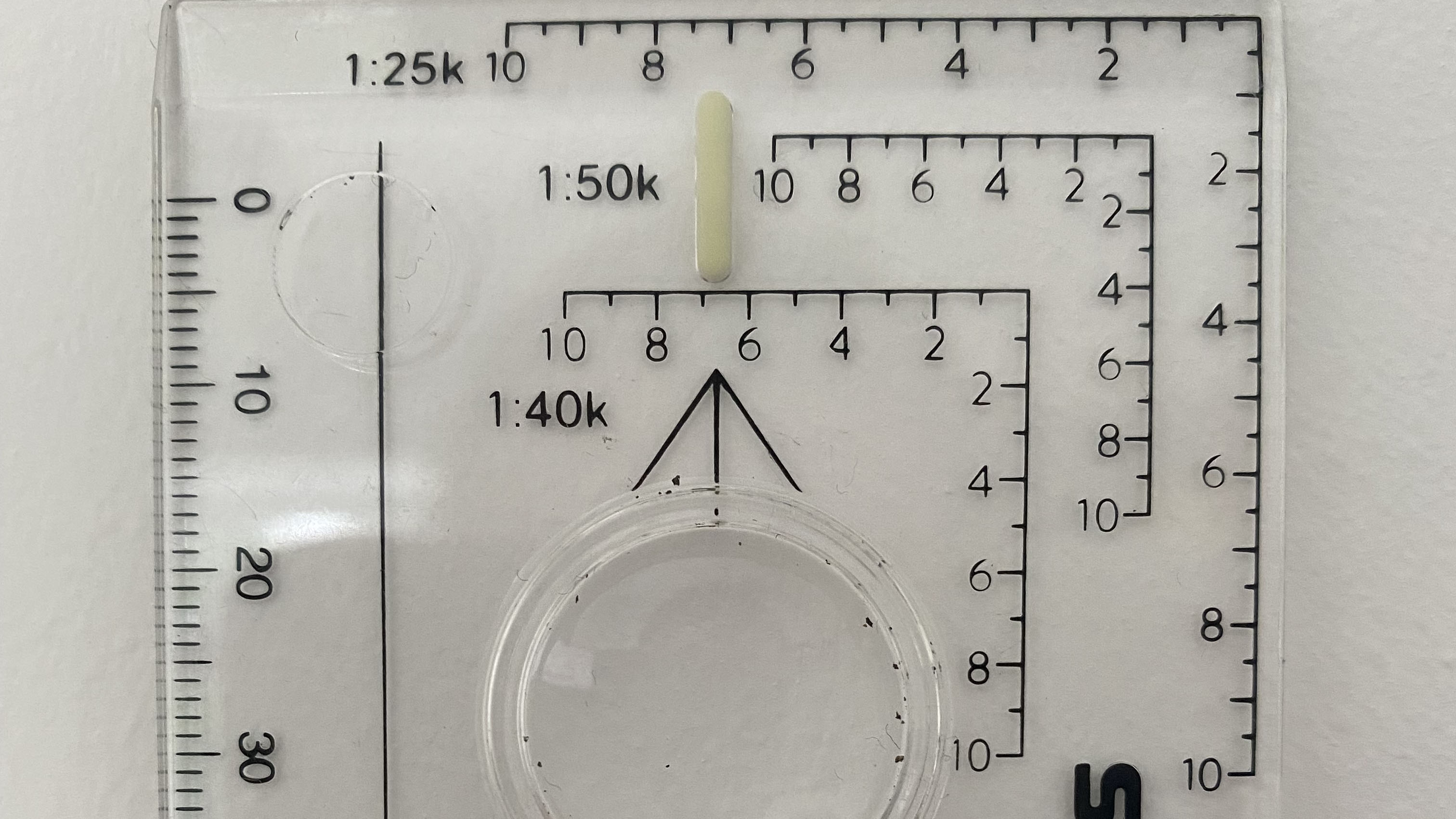
A quality baseplate compass will have a Romer, which can be used to measure distances you plan to cover with your best hiking shoes, and to aid your grid reference calculations too. As you can see on the compass above, there are three different Romer scales to be used depending on the scale of the map. In each instance, the intervals measure 100m, with an additional 50m interval on the 1:25k scale.
To use the Romer to help arrive at your grid reference, place the location you want to describe in the 0 corner of the Romer, as shown in the example below for Wasdale Hall using the 1:40k scale.
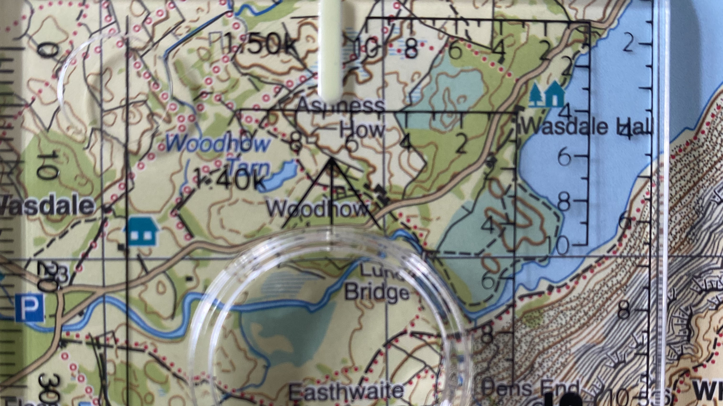
Start along the corridor again, this time looking back along the horizontal line to where it crosses the vertical 14 grid line. As we had estimated, Wasdale Hall is around 500m east of the 14 line, and its reading is therefore 5, giving it an Eastings reference of 145.
Next, it’s the stairs again, but this time look down the vertical Romer line to where it crosses the horizontal 04 line. Wasdale Hall is just over 500m north of the 04 line, so once again that’s a reading of 5. The Northings reference is 045.
Once again, when all is put together, the six-figure grid reference is NY 145 045.
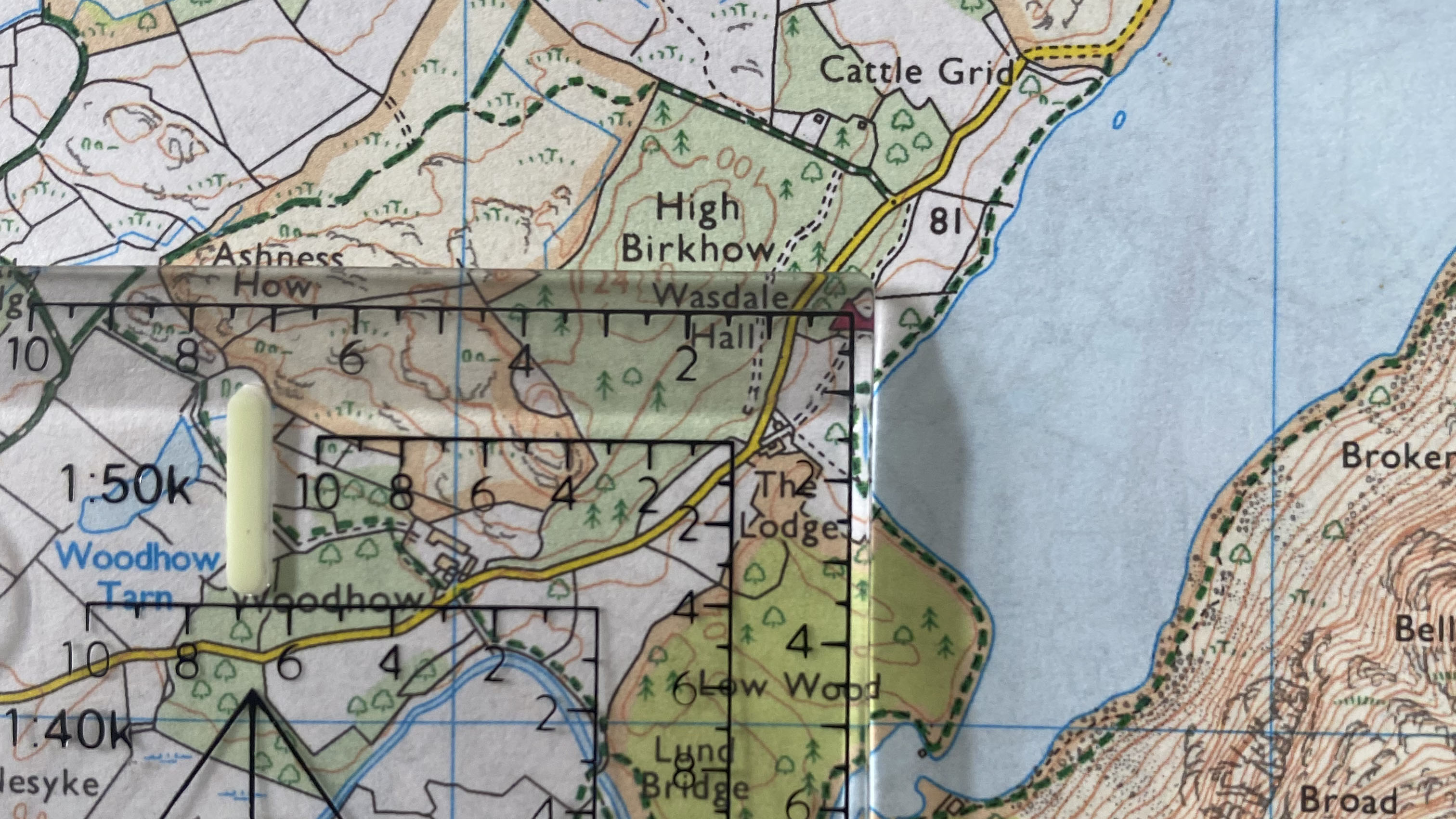
The examples so far have been on 1:40k scale maps, but the same applies whatever scale you are using. Just remember to use the appropriate Romer scale when measuring. The example above shows the same Wasdale Hall on a 1:25k map, measured using the 1:25k Romer.
What is what3words?
One of the most recent developments in location technology and one of the best navigation apps is what3words, a platform that has given every three-meter square in the world a unique three-word address.
The addresses stay fixed, so the Statue of Liberty will always be ///sulk.camps.sits, while the summit of Snowdon in Wales will always be ///perfectly.traffic.decking. The app uses GPS to pinpoint your location, from which you can simply select the square and get your three-word address. Many organisations, including delivery and rescue services will accept a what3words address when communicating with you.
Alex is a freelance adventure writer and mountain leader with an insatiable passion for the mountains. A Cumbrian born and bred, his native English Lake District has a special place in his heart, though he is at least equally happy in North Wales, the Scottish Highlands or the European Alps. Through his hiking, mountaineering, climbing and trail running adventures, Alex aims to inspire others to get outdoors. He's the former President of the London Mountaineering Club, is training to become a winter mountain leader, looking to finally finish bagging all the Wainwright fells of the Lake District and is always keen to head to the 4,000-meter peaks of the Alps. www.alexfoxfield.com

